The Port Alberni Port Authority has been working on a Port Alberni Transshipment Hub (“PATH”) on the Alberni Inlet 30km south of Port Alberni. They have signed a working agreement with the Huu-ay-aht First Nation and are working in conjunction with the City of Port Alberni and Alberni Valley Regional District.
This is the greatest opportunity for Asia-Pacific traffic to move into Port Alberni for many years.
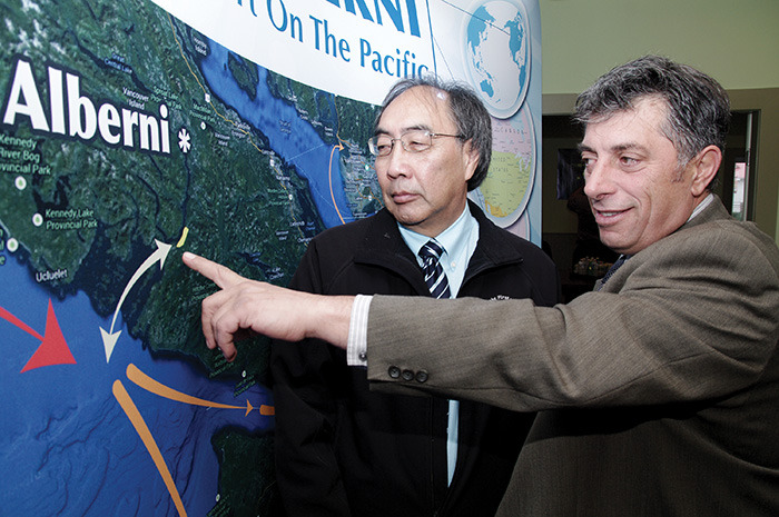
Photo from Alberni Valley News:
The hub would accept container vessels from Asia, unload their cargo, sort and then reload the containers onto tug barges for delivery direct (or much closer) to customer warehouses in Vancouver, the Fraser River, Puget Sound and even as far as Portland.
Railway in a Supporting Role
The PATH project would not necessarily require direct railway service. It’s main purpose is to move containers by short-sea shipping. However, the shear scale of the project would mean a big increase in industrial traffic into the City of Port Alberni and that is likely to hold opportunities for the railway. The potential day-to-day operations, and spinoff business from the construction and maintenance of a facility this large could potentially require and benefit from the railway into Port Alberni.
Opportunities would include both material during construction and supplies and material during operation. There is also the possibility that bulk goods or other goods will be exported through facility, especially in early years, so there is potential for the railway to bring those goods to the rail head at Port Alberni before it is transferred to the facility by truck.
More details on the potential for this facility should come to light when the feasibility study is complete in Spring 2014.
So what about an extension?
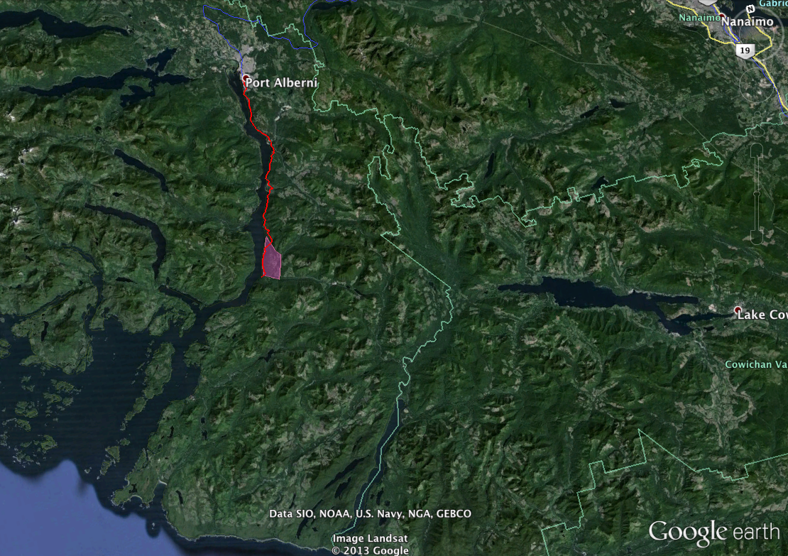
Below is a map that shows the general site of the Transhipment Hub (in pink) and a potential extension to the railway along the Inlet from Port Alberni (in red). This extension is not part of existing plans for the PATH. This extension would follow the historic Canadian National Pacific Railway right-of-way that was cleared and levelled from Youbou and Lake Cowichan to the Alberni Inlet, but never completed. Some of this right-of-way is now a wilderness trail.
This is unlikely to be feasible or a part of the plan, however, it is something to consider if ever there was a major expansion in shipment needed that could not be handled by barge.
Download a KML of the path for use in Google Earth here.
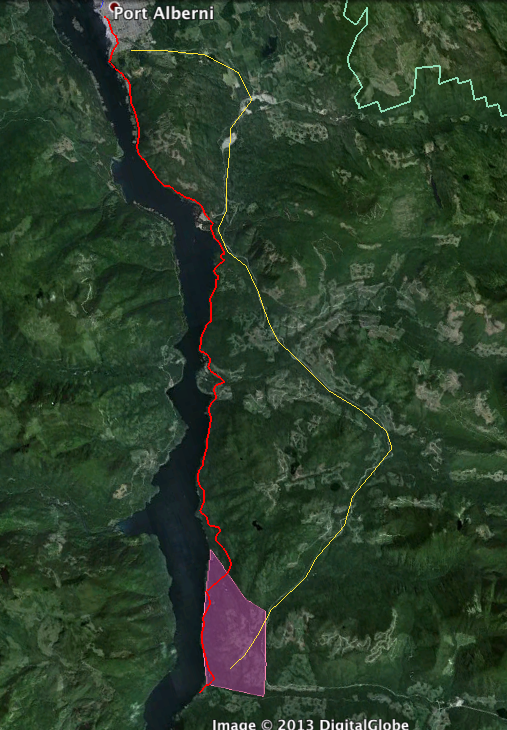 The railway (red) would be almost identical in length at 31 km (19.5mi) vs. 32 km (20mi) for the existing Bamfield logging road.
Building this rail link would be extremely challenging. It would cross multiple First Nation traditional territories (Tseshaht, Hupacasath and Huu-ay-aht) and one Indian Reservation at Polly’s Point immediately south of the City of Port Alberni.
The CNPR grade would facilitate the construction somewhat by providing approximately 15 kilometres of existing grade. However there are dozens of stream and river crossings and challenging terrain. The existing logging road to Bamfield and Cowichan from Port Alberni would most likely be paved.
The potential direct link to Class 1 North American railroads through Southern Railway of Vancouver Island, Seaspan and Annacis Island, may prove attractive to shippers.
The Federal Government is funding a feasibility study of the PATH that should be complete by April 2014.